
In this guide
A South Rim day with a realistic overnight approach and optional second viewpoint day.
All topics and planning links
Match the outing to your access needs
Use the named park’s official accessibility information and ask about the exact surface, slope, distance and transport you need.NPS park websites provide information about accessible features, programs and services. Use the named park’s information to check surface, slope, distance and transport for the outing you actually choose.Checked 2026-10-07 · Source
Start with the view you came for
Use Mather Point and a selected portion of the rim route for the first substantial view. Then choose the village or another viewpoint interval rather than immediately driving to every overlook. The canyon changes with light and position; time at a few places is more useful than a rushed list.
The rim and the descent ask different things of the group. A short rim-based visit can be a complete day. If you choose to go below the rim, use the NPS trail and safety information for the specific route and the return climb; the outward descent is not the full commitment.

Start with this decision
For a first visit, build the trip around the South Rim and choose a base before choosing a hotel. Grand Canyon West is a separate destination outside the national park; a ticket advertised simply as “Grand Canyon” may take you there.
- Suggested stay
- Choose the nights around your arrival, departure and selected outings.2–3 daysPlanning estimate · reviewed 2026-10-06 · Source
- Getting around
- Check the actual route and current transport for the dates and base you choose.Useful for arrival; South Rim shuttles connect many viewpoints.Planning estimate · reviewed 2026-10-06 · Source
- When to go
- Check the intended season, official access and local conditions before booking.Spring and fall for rim walks; winter brings ice and summer brings heat below the rim.Planning estimate · reviewed 2026-10-06 · Source
Use one rim section each morning or afternoon. Keep hiking below the rim as a deliberate choice with a turnaround time; the return climb takes effort after the downhill feels easy.
Choose your base
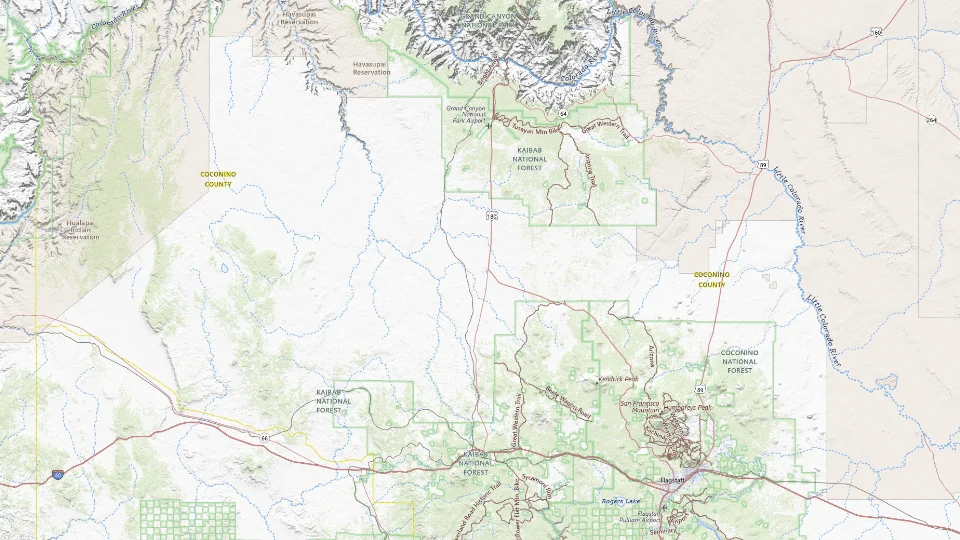
- Grand Canyon Village
- Tusayan
- Williams
Map sources and credits
USGS The National Map: National Boundaries Dataset, 3DEP Elevation Program, Geographic Names Information System, National Hydrography Dataset, National Land Cover Database, National Structures Dataset, and National Transportation Dataset; USGS Global Ecosystems; U.S. Census Bureau TIGER/Line data; USFS Road data; Natural Earth Data; U.S. Department of State HIU; NOAA National Centers for Environmental Information. Data refreshed September 4, 2026-v1.2
Original map service| Area | Choose it for | Tradeoff |
|---|---|---|
| Grand Canyon Village | Rim access when lodging operations are available. Reopening after the last verified closure is not confirmed here. | Read the NPS lodging notice before relying on an in-park reservation; Tusayan is the nearby outside-park alternative. |
| Tusayan | A gateway hotel close to the South Entrance. | You still need to enter the park; entrance queues can undo a tight schedule. |
| Williams | A Route 66 stop or a planned Grand Canyon Railway trip. | It is a substantial drive from the rim; not the base for several quick sunset visits. |
A sensible first visit
- Arrive at the South Rim and take a short walk close to your accommodation.
- Spend the morning on the Rim Trail, then use a shuttle route for a different set of overlooks.
- Add a short below-rim walk or Desert View only after checking conditions and the onward journey.
Choose the activities that fit
Rim Trail and village viewpoints
First-time visitors who want views without a descent. Surfaces and accessibility vary by section; do not assume the entire trail is paved.
Half day or more · Self-guided walk
Check rim trail and village viewpoints detailsHermit Road viewpoints
Comparing several viewpoints without moving the car each time. Seasonal vehicle restrictions affect how you reach the overlooks.
Half day · Shuttle and short walks when the shuttle operates
Check hermit road viewpoints detailsA short below-rim hike
Prepared hikers who understand the return climb. Heat below the rim, water availability and trail work can change the plan.
Choose a conservative turnaround · Self-guided hike
Check a short below-rim hike detailsBefore you book
Check the official visitor information for current access, booking requirements and restrictions in Grand Canyon before choosing dates or paying. The previous operational note is awaiting a fresh review.The North Rim has separate access and operating conditions. Do not book it as an interchangeable substitute for South Rim lodging. Check official alerts before choosing a rim or a cross-canyon drive.
Three “Grand Canyon” products that are not one place
South Rim, North Rim and Grand Canyon West are different approaches. The Skywalk belongs to the Grand Canyon West decision; it should not be implied as an included stop on this South Rim plan. North Rim also has its own seasonal access and facility conditions.
For the South Rim, Hermit Road and Desert View form different viewpoint sequences. Use current shuttle and road information for the date. A second day can stay on the rim without requiring a long hike or a cross-canyon transfer.

The overnight location decides your early and late views
A rim-area stay, when confirmed operating, can keep the early or late viewpoint interval local. Tusayan supplies an outside-park alternative. Williams creates a different stay with a road or railway journey to the rim. A property name containing Grand Canyon does not settle that distance.
Current in-park lodging reopening after the last verified closure is not confirmed here. Use the lodging notice and official property status before relying on an in-park night. Keep the trip workable with an outside-park base instead of treating a supplier listing as proof that an affected operation has resumed.

A short day in A short South Rim visit
Use the current park shuttle or an allowed road route after checking alerts.
Allow roughly half a day, plus arrival and a meal. The times below are planning estimates; opening hours, reservations and current conditions need a separate check.
Grand Canyon Visitor Center
30–45 min · Check current South Rim access and services before setting out.
Mather Point
45–60 min · Choose a rim viewpoint without descending into the canyon.
Yavapai Geology Museum
45–60 min · Continue to the geology viewpoint only if current transport and conditions support the visit.
- Rest and lunch
- Carry food and water; do not rely on a particular restaurant being open during the current service disruption.
- If the plan changes
- Use only the visitor-center and nearby viewpoint stops if an alert, storm or transport change affects the longer circuit.
- Access check
- Confirm current NPS accessible routes and shuttle boarding. Rim paths and below-rim trails require different preparation.
What to plan next
Sources and planning checks
Research-based guidance, with editorial judgments about pace and location. Check the official provider for current access, prices and booking terms.
- NPS Grand Canyon lodging — Village and Tusayan lodging geography. Reviewed 2026-10-06.
- NPS South Entrance — Access from Williams, Tusayan and Flagstaff. Reviewed 2026-10-06.
- NPS: Grand Canyon conditions — Current road and facility notices; does not establish lodging reopening. Reviewed 2026-10-08.
- NPS: Grand Canyon first-visit planning — South Rim places, transport and separate North Rim or Skywalk choices. Reviewed 2026-10-08.


