In this guide
An Arches day, an Island in the Sky day and an optional separate overlook outing.
All topics and planning links
Choose formations you can spend time with
Balanced Rock and The Windows can shape an Arches visit, with another route chosen from the official descriptions. Delicate Arch’s main trail is a different commitment from seeing a formation from a viewpoint. Exposed walking and the return need to suit the whole party.
Use current NPS entry information for the year and date. Older Utah guides may describe a timed-entry system that does not match the published 2026 change. A general park pass and a specific access requirement remain separate questions, even when no reservation is required.
Check the current Arches general-entry rules and separate campground or Fiery Furnace requirements with NPS before travel.NPS removed advance timed-entry reservations for general entry in 2026. An entrance pass is still required; Devils Garden Campground and Fiery Furnace hikes retain separate reservations. Congestion can temporarily restrict access to particular locations.Checked 2026-10-08 · Source

Start with this decision
Stay in town for easy meals and trip supplies. A farther-out cabin or campground suits a trip with time at the property, but adds driving to food and park access.
- Suggested stay
- Choose the nights around your arrival, departure and selected outings.3–4 daysPlanning estimate · reviewed 2026-10-06 · Source
- Getting around
- Check the actual route and current transport for the dates and base you choose.Useful for the national parks and dispersed trailheads.Planning estimate · reviewed 2026-10-06 · Source
- When to go
- Check the intended season, official access and local conditions before booking.Spring and fall for walking; summer heat changes the daily schedule.Planning estimate · reviewed 2026-10-06 · Source
Give Arches a day and Island in the Sky another. Put a guided river or off-road excursion on a separate block, checking the operator’s route and physical requirements before booking.
Choose your base
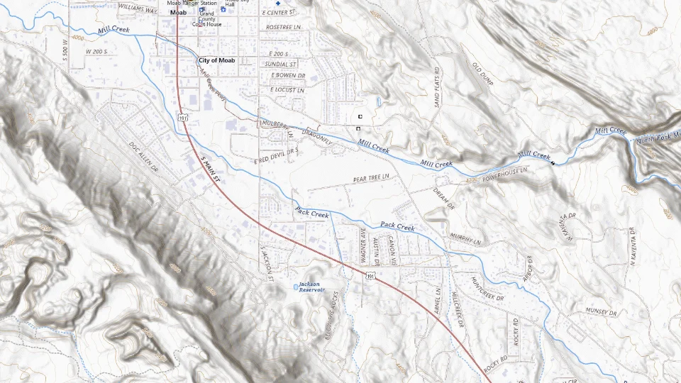
- Central Moab
- Outlying cabins / campgrounds
Map sources and credits
USGS The National Map: National Boundaries Dataset, 3DEP Elevation Program, Geographic Names Information System, National Hydrography Dataset, National Land Cover Database, National Structures Dataset, and National Transportation Dataset; USGS Global Ecosystems; U.S. Census Bureau TIGER/Line data; USFS Road data; Natural Earth Data; U.S. Department of State HIU; NOAA National Centers for Environmental Information. Data refreshed September 4, 2026-v1.2
Original map service| Area | Choose it for | Tradeoff |
|---|---|---|
| Central Moab | Restaurants and a practical multi-day base. | Main-road noise varies by property. |
| Outlying cabins / campgrounds | Space and a slower outdoor stay. | Errands and meals take more driving. |
A sensible first visit
- Settle in and choose a short outing close to town.
- Use one day for Arches and another for Island in the Sky.
- Add a guided activity only if there is time beyond those park days.
Choose the activities that fit
Arches National Park
A first introduction to sandstone arches. Famous hikes still need heat-aware preparation.
Full day · Self-drive and selected hikes
Check arches national park detailsCanyonlands: Island in the Sky
Broad canyon views without confusing park districts. The Needles is a separate district with a different access road.
Full or half day · Scenic drive and short walks
Check canyonlands: island in the sky detailsBefore you book
Check the official visitor information for current access, booking requirements and restrictions in Moab before choosing dates or paying. The previous operational note is awaiting a fresh review.Reservation systems change by year. Check the current Arches entry page rather than reusing an old rule. Desert heat, flash-flood risk and remote-road conditions need their own planning.
Island in the Sky is one district, not all of Canyonlands
Use Island in the Sky for a first canyon-overlook day from Moab. Mesa Arch and selected overlooks can make a coherent sequence, with the exact walk chosen for its surface and conditions. Leave time at the viewpoints rather than trying to reach another district the same afternoon.
The Needles has another approach and another kind of outing. It is not a stop across the same park road. Choose it deliberately for a longer visit and use its own NPS planning information. A single Canyonlands title should not conceal that difference.

Dead Horse Point or a flexible Moab day?
Dead Horse Point creates another overlook outing with its own admission and current access. It can fit a spare day when the main park visits worked, or remain secondary when weather displaces a priority. Keep that flexibility instead of assigning another strenuous hike to every free interval.
For the Utah route, preserve the several-night Moab base so Arches and Canyonlands are full days. Check the actual departure gateway before treating the last morning as another park visit. A transfer to a distant airport can require another overnight.

A short day in A short Arches visit
Car or a confirmed tour; check park entry conditions and road alerts.
Allow roughly half a day, plus arrival and a meal. The times below are planning estimates; opening hours, reservations and current conditions need a separate check.
Arches Visitor Center
30–45 min · Start with current entry, weather and walking advice.
Park Avenue viewpoint, Arches
30–45 min · Choose the viewpoint instead of assuming the longer trail fits every group.
Balanced Rock, Arches
30–45 min · Use a brief authorized viewpoint stop, with no climbing on formations.
- Rest and lunch
- Carry water and a snack; do not rely on buying food inside the park.
- If the plan changes
- Use the visitor center and return to Moab when heat, storms or a closure makes the viewpoints unsuitable.
- Access check
- Verify each viewpoint approach with NPS. Desert heat and uneven ground matter even on short visits.
What to plan next
Sources and planning checks
Research-based guidance, with editorial judgments about pace and location. Check the official provider for current access, prices and booking terms.
- Discover Moab: Arches reservations — Published 2026 timed-entry change; confirm current park requirements. Reviewed 2026-10-08.
- NPS: Canyonlands planning — Separate districts and their approaches. Reviewed 2026-10-08.
- NPS: Arches places to go — Distinct Arches areas and visitor resources. Reviewed 2026-10-08.

